
Dubai Municipality launches the 3D Infrastructure Lines Mapping Project
Dubai Municipality launched the "3D Infrastructure Lines Maps" project, in implementation of the government's directive to transform the Dubai government into a fully intelligent model, and as a commitment from the municipality to provide the finest and best services in accordance with international and innovative standards in various fields.
Project Objectives
Daoud Al-Hajri, Director General of Dubai Municipality, said: “The project aims to prepare a comprehensive study to choose advanced technology to produce a 3D model and a comprehensive map of all geospatial data for underground infrastructure service lines, and the details that must be integrated into a unified source of information. The study includes testing The latest technological means available globally in the field of preparing underground infrastructure maps, such as "Ground Penetrating Radar Technology (GPR)", and then selecting the most appropriate ones in order to sustain the collection of information and cover all parts of the emirate to update the information.
Stages of the project
Engineer Maryam Al Muhairi, Acting Executive Director of the Buildings Regulation and Licensing Agency in Dubai Municipality, said: “The project is being implemented in two phases. All existing infrastructure lines through the technology that has been provided, in preparation for the modernization of all data.
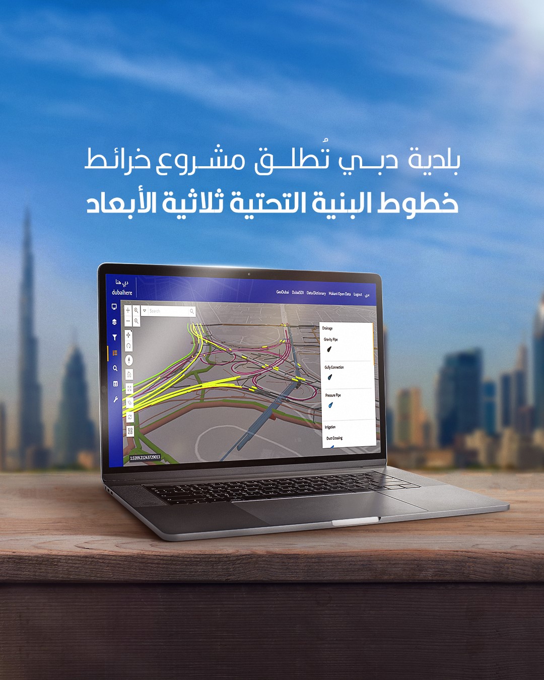
Uses of modern technology to survey 3D underground infrastructure lines
Modern technology is used to scan the three-dimensional underground infrastructure lines to enhance the accuracy of the data currently available in the geospatial database, in addition to providing all the required data, which includes data of all service agencies, such as data of irrigation, sewage and rainwater lines of Dubai Municipality, and data of pipelines Electricity and water of the Dubai Electricity and Water Authority, and road lighting lines of the Roads and Transport Authority.
Underground infrastructure lines are also scanned, processed, and provided to the data-owning entities to update them, as data is considered one of the most important elements of success in the sustainable digital twin goals, which Dubai Municipality seeks to achieve in order to facilitate and shorten the time for operations that include three-dimensional infrastructure information, including, for example, certificates of non-compliance. Impedance and infrastructure projects and related buildings.
Follow our latest local and sports news and the latest political and economic developments via Google news